
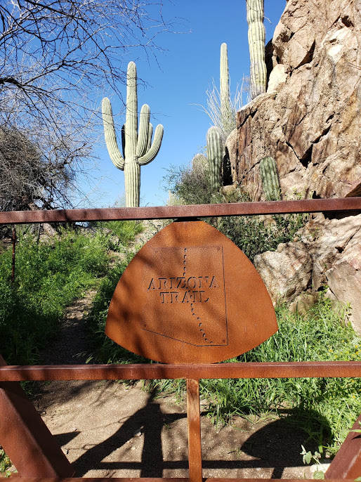
On this stretch of the AZT between Oracle and the boundary of the Superstition Wilderness, water sources are scarce and interesting, I skirt the Gila River, find a cool rock, climb above a canyon, meet some more awesome trail angels, and experience the rainbow of colors that the Arizona desert has to offer! Here’s the latest, from mile post 198 to 308.
Day 11: American Flag Trailhead to Dirt Road, 22 miles
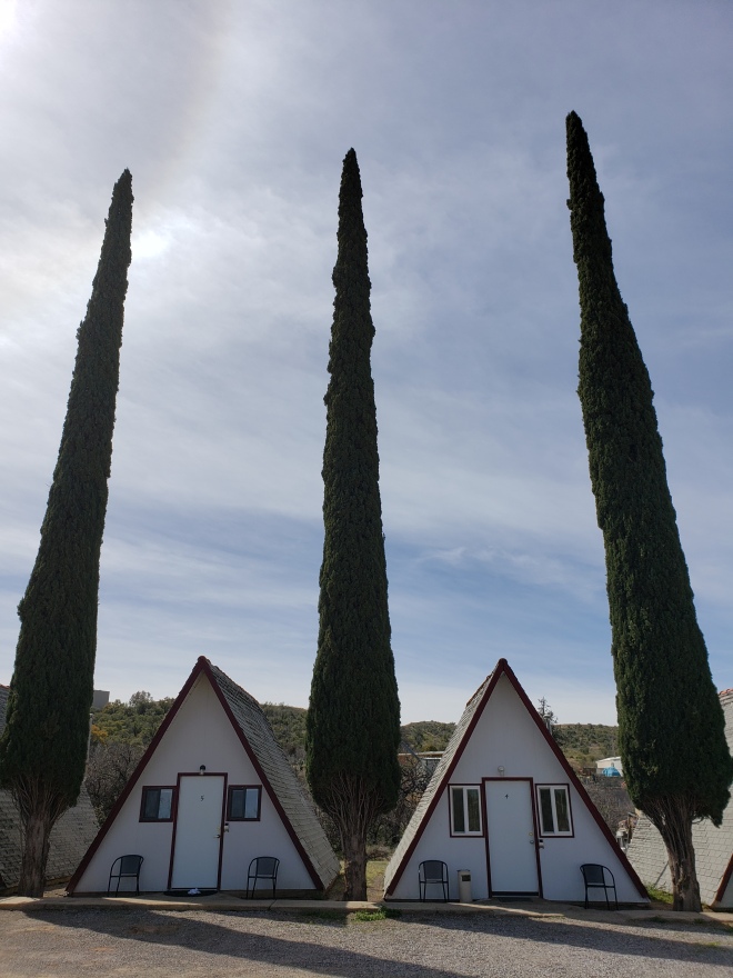
I wake up in my little A-frame chalet at Marnie’s place with slightly swollen feet and a mild headache thanks to sleeping with the TV on all night. I switch off the stream of old westerns and get to packing up my things and rinsing away my pains under a hot shower. Breakfast is a microwave burrito leftover from last night and cold coffee.
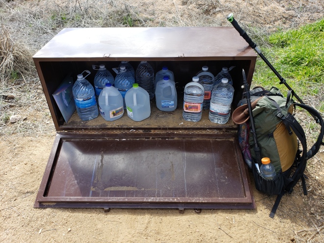
I settle up with Marnie late in the morning, and she informs me of a water cache she maintains ten miles ahead so that us hikers, in her words, “won’t have to drink cow shit tea from the stock pond.” Her husband takes me back up to the American Flag trailhead in his Jeep and sees me off.
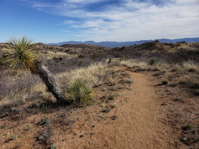
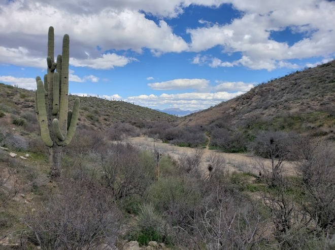
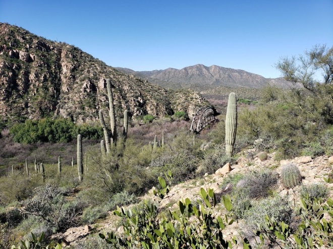
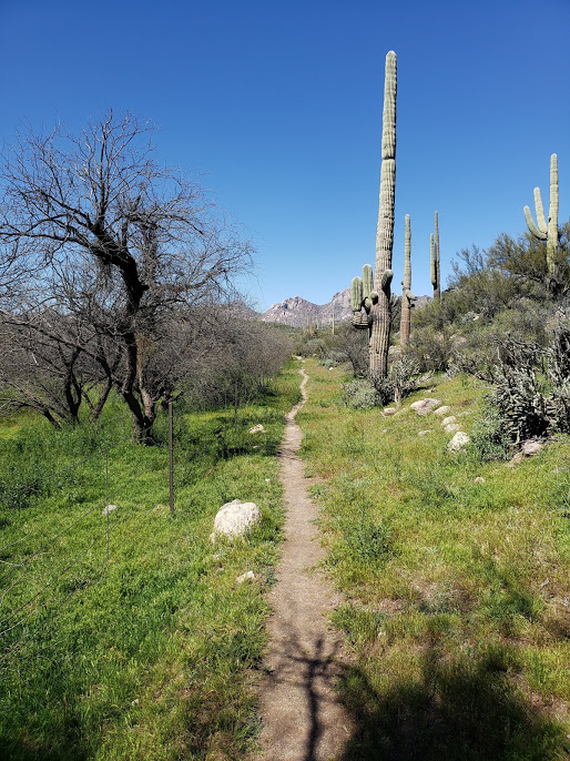
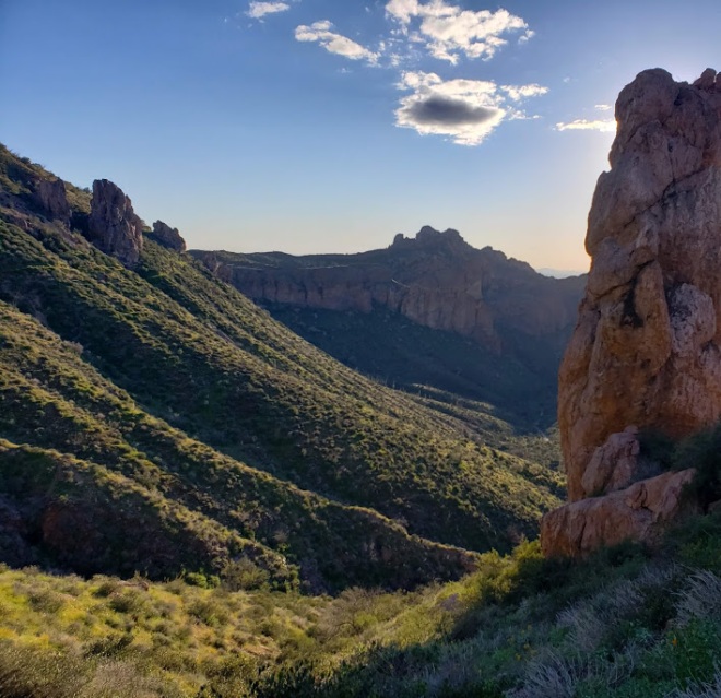
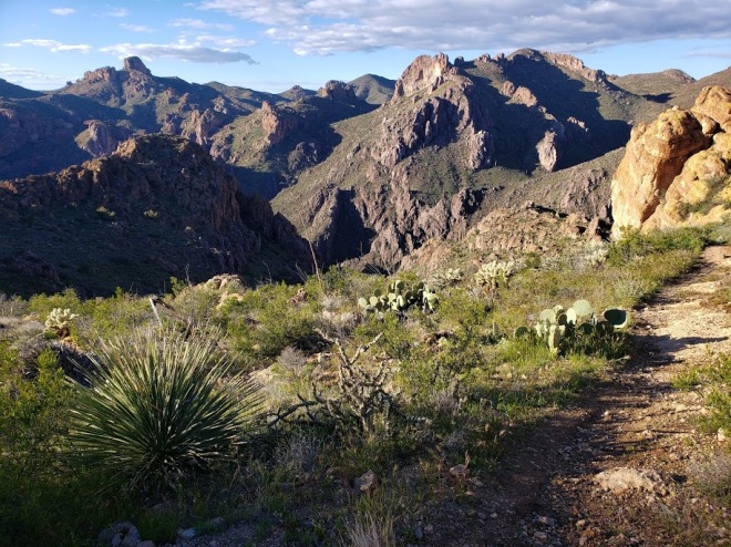
It’s a warm day, but not yet sweltering. The trail dips in and out of washes, over rolling hills and through an abundance of barrel cactus and prickly pears. The Santa Catalina Mountains rise up out of the east, and just ahead, the infamous Superstitions.
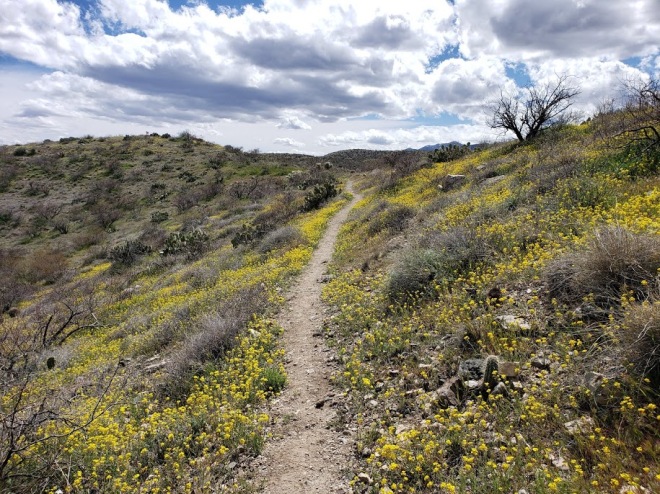
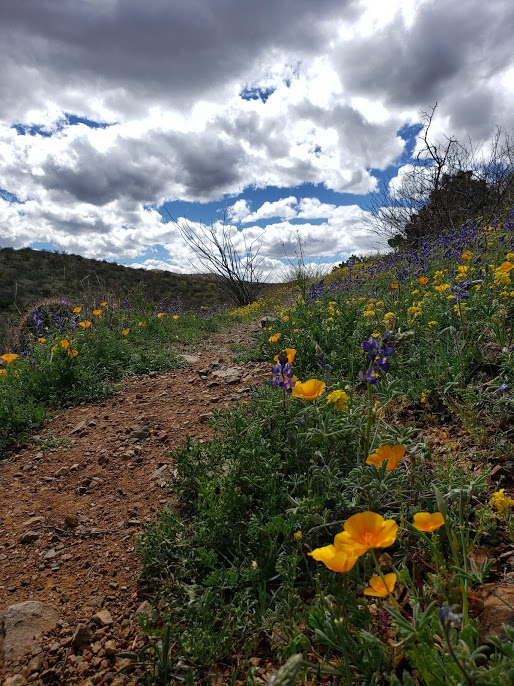
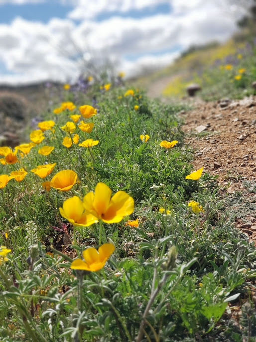
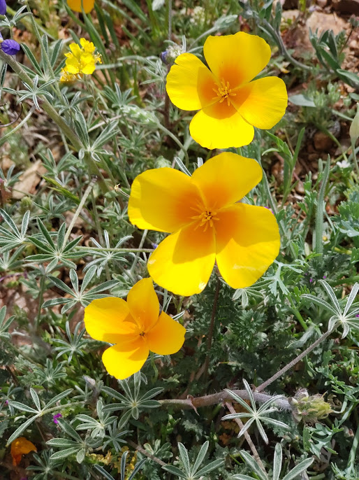
I reach the water cache in fairly good time, fill up and help myself to the jar of hard candies that Marnie has left. From here, I pass under a highway and wrestle with a shoddy cattle gate. A bit of road walking leads me to another trailhead, where the path picks up through a super bloom of California poppies and fragrant purple lupines. The Saguaros make a triumphant comeback, and a bright flock of red cardinals brings a grin to my face. I’m very happy to be in this land of rainbows.

A lovely group of day hikers stops me to chat, amazed at the endurance of thru-hiking. These reactions always make me feel slightly strange, especially when they refer to me as brave or fearless. “It’s just walking,” I assure them, but they’re excited for me and it feels nice anyway. They inform me that there’s another hiker just ahead, and I’m curious to meet this dirtbag who has so far eluded me. It’s been a bit lonely out here, after all, and a bit of conversation with like-minded adventurers is always appreciated.
I finally catch up this mystery hiker after a few miles, but he seems a bit hesitant to start conversation, so I just introduce myself and move on. The trail is gaining some elevation now, and I want to get up and over this mountain before making camp for the night; I’m determined to get a full day in despite my late start.


As the sun goes down on another brilliant day in the Arizona high desert, I find a somewhat flat, cactus free spot to pitch my shelter in between a crooked Saguaro and a mesquite tree.
The other hiker, Scott, catches up to me, and gets excited over my tarp.
“Is that Zpacks pocket tarp?”
“Yep.”
“You officially win ‘most hardcore’ with that setup.” He jokes. He’s rocking a tiny backpack too, and I’m tickled pink at the compliment from a fellow ultralighter.
He pushes on into the night, and I settle into camp to make some dinner. Critters call through the darkness, but I’m not too worried about it. Maybe I am braver than I give myself credit for.

Day 12: Dirt Road to Another Dirt Road, 28 miles
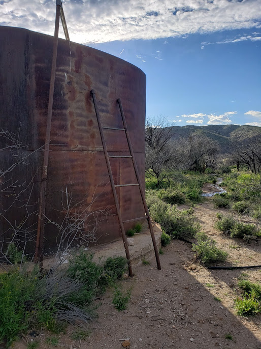
In the morning, the trail gives way to a dusty road walk. Rain clouds loom overhead, giving the sky a dark and dramatic flair. The first thing on the agenda for the day: get water from a tank that’s off trail. According to the comments on Guthook, it’s good water, but a pain in the ass to get to.
I catch a glimpse of the tank from the road, which is situated in a canyon below me. The comments are right, as it’s a bit of a scramble on loose scree to get to it, plus the always not-so-fun task of dodging cholla cactus.
The tank is off limits to cattle, with a large tower structure only accessible by climbing a ladder to the piped water pouring into the opening at the top. It’s a tedious task, holding onto the ladder for dear life with one hand and trying to fill your bottle with the other. After filling up and filtering, I take a break and make some matcha tea and have a bit of breakfast.


With the weather seemingly changing for the worse, I decide to pack it up and press forward. I follow the canyon for a bit in hopes that I will find an easier way to scramble back up to the road, but quickly abandon this idea as the canyon walls become steeper the more I progress. I backtrack a bit, and then follow a cow trail back.
It’s flat and easy hiking from here on out, and although it spits fat raindrops here and there, it holds off on torrential downpours. A rainbow rises from the poppy covered hills.
The miles come and go, and by late afternoon, I’m still following road across the desert. I walk under high voltage power lines for some time, discomforted by the electric noises they make. The wind has picked up a bit, and brought more weather with it. I have a feeling I’m in for long, rather wet night.
Before looking for an appropriate campsite, I visit another water source off trail. This one is uphill from the road, and it’s an underground guzzler cistern. This one thankfully doesn’t require any climbing, but the water has much more floaties in it than the previous tank.


I continue up the road, which becomes more and more washed out the further I go. There’s no flat ground for making camp, so I walk until nearly dark. At a road crossing, a couple of car campers retreat to their vehicle as the rain starts to come down. I find a suitable area further up the trail, hidden in a stand of mesquites. The car campers are within sight of my setup, which oddly brings me some comfort knowing there are others around.
The rain really picks up, and I hunker down under my tarp and in my bivy. The ground is now saturated and smells like cow piss. Great, I’ve made camp in the local bovines’ favorite chill spot.
Despite the rain pelting against my tarp, I fall asleep quickly.
Day 13: Another Dirt Road to Gila River/Kearny, 15 miles
I’m jolted awake suddenly in the middle of the night by the sound of the wind swirling overhead. I’m overcome with a chill as well, and discover that I’m absolutely drenched. The tarp hasn’t done much to keep the storm out. I try to fall back asleep, but I can’t ignore the icky, damp feeling. The town of Kearny is on the forefront of my thoughts.
Luxury. Warmth. Hot foods and a shower. Time to pack it up and move out.
I stuff all my soggy gear into my pack and move out, anxiously awaiting daybreak. By first light, I’m leaving an arroyo and starting a rather laborious climb over a mountain. I catch back up to Scott again, who’s huddled up beside the trail eating beef jerky for breakfast. We walk together for a bit to a water cache, also maintained by Marnie, and help ourselves to more hard candies and water. He’s skipping Kearny, heading instead towards Phoenix via the AZT and GET. I can’t wait to get to town and finally get warm and dry, and haul ass out of there.
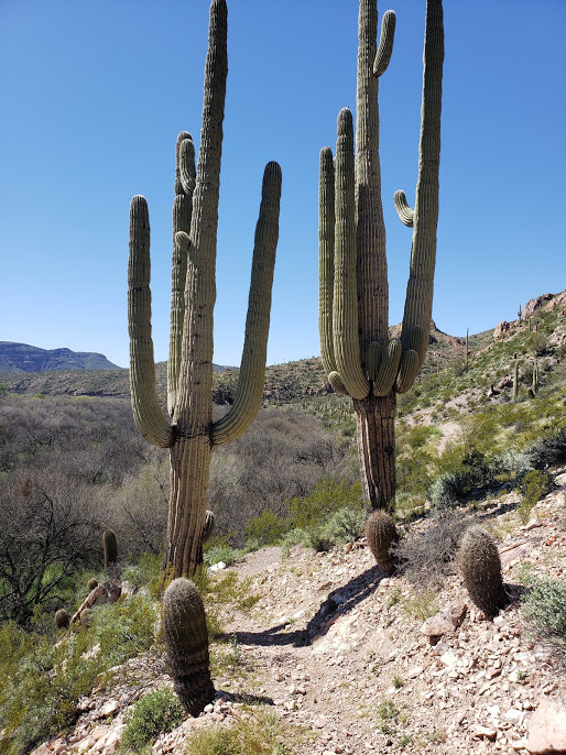
We descend on winding trail through more Saguaro and cholla, down into the Gila River Valley, where we part ways. I walk the two miles on a paved side road to the highway, and attempt to hitch into town. However, no one wants to pick up a wet and dirty hiker. Snow birds in ‘retirement gold’ colored sedans sneer at me as they zoom past. After awhile, I start to get a complex; do I really look that bad?
I give up and start trucking it up the highway, on the verge of tears. It’s around fifteen miles into town, and I’m so tired and cold. Thankfully, a pickup pulls over and a nice lady tells me to hop in. She’s the owner of the motel in town, and picks up hikers often. She’s now just scored a new guest.
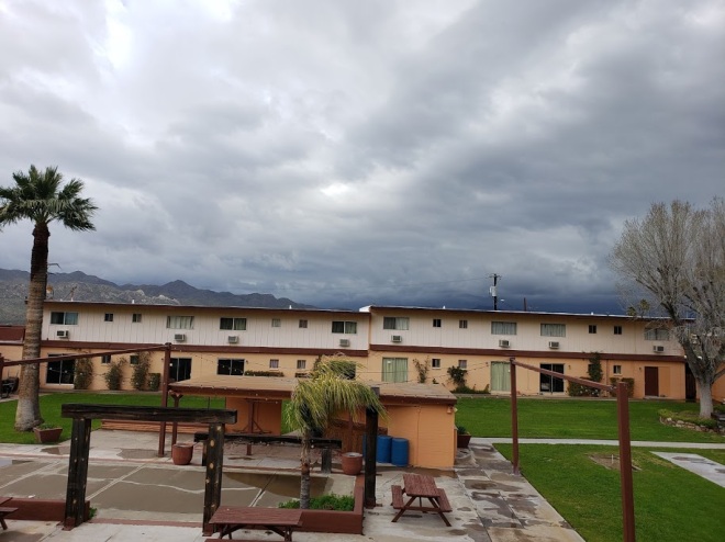
In Kearny, I get a room, crank up the heat and lay out all my gear to get dry. After a shower, I grab my resupply box from the post office and some sandwich makings from the market. The storm rages on outside, but I’m now comfortable and warm in a real bed, and watching HBO. It’s oh-so luxurious.
Hiking in shit weather sure makes you appreciate the little things in life.
Day 14: ZERO Day in Kearny
As I stumble into the bathroom of my room at the General Kearny Inn, I catch a glimpse of the weather outside, and it’s grim.
“Nope. Hell no,” and I crawl back into bed. It is nasty outside, with high winds blowing in sideways rain. I decide to take an unscheduled ZERO day here in town, and enjoy these creature comforts a little bit longer. The trail isn’t going anywhere.
There’s a dollar store across the street from the motel, so I stock up on snacks and Epsom salts for a soak in the tub. It turns into a ridiculously relaxing day, one that I hadn’t fully realized my body was desperate for.
It was the right choice, and I have no regrets.
Day 15: Gila River/Kearny to Ridge Camp, 27 miles
The weather has cleared, the sun is shining and it’s time to get back at it.
I try and get an early start, getting my things put way and heading back out to the highway after a having a microwave breakfast burrito. It’s quiet in town, and there isn’t much traffic on the road at this hour. The industrial sounds of the nearby open pit copper mine are the only thing heard, from a distance.
A man in a pickup truck leaving town gives me a lift, and his wife happens to be the manager of the motel. The General Inn seems to be the gift that keeps on giving in this sleepy corner of the trail. He’s recovering from a kidney transplant, and is happy to just be getting out of the house and helping out hikers. It’s much appreciated.
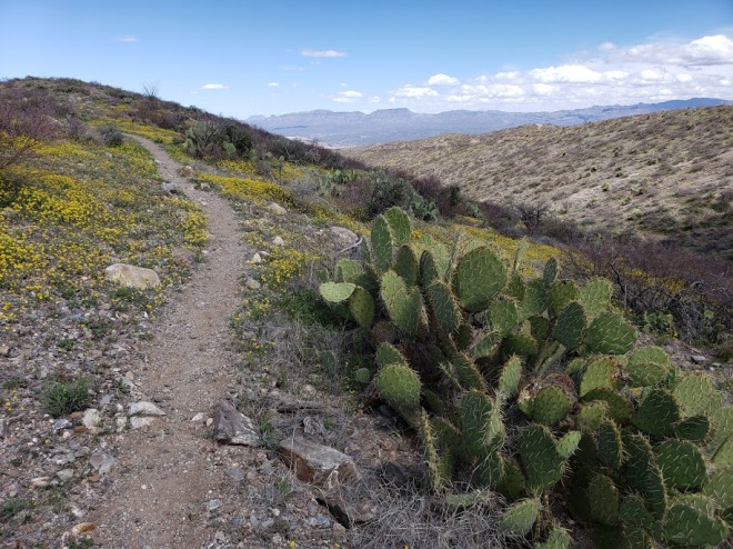
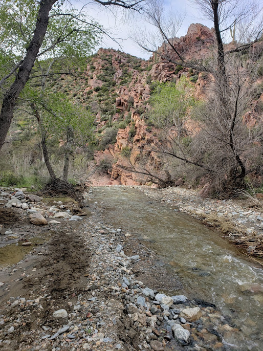
The trail picks back up along the Gila River, skirting its banks for some time, and weaving through more Saguaro. A group of young bulls eyes me from the other side of a barbed wire fence, and I’m thankful that the fence is in place.
Midday, I look for a way down to the river to get water, but any access is blocked off by fresh fencing put up by cattle ranchers. I attempt to crawl under one of the fences, but a group of side-by-side ATV’s scares me off. I start a climb up a dusty road, where more ATV’s ride past me. One of them stops and offers me water, and I stupidly refuse. Further on, the standing pools of stagnant water that were listed on Guthook are dried up, and I curse at myself for being so stubborn.
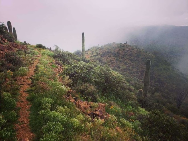
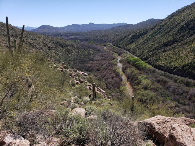
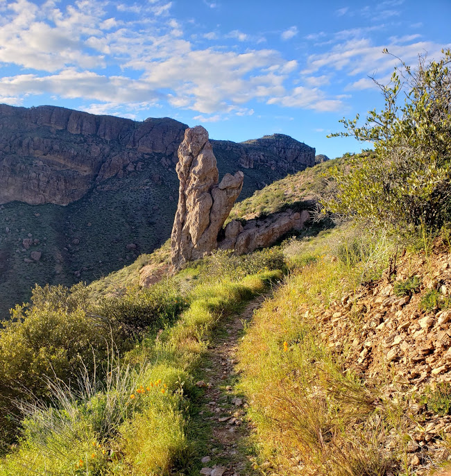
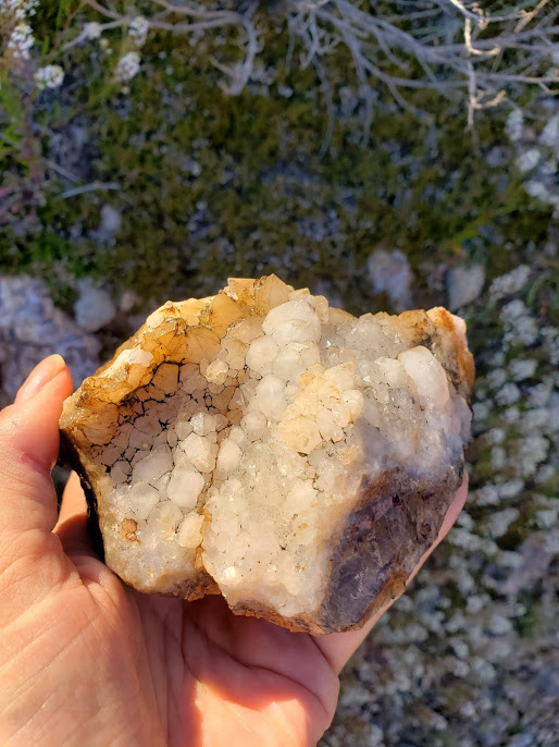
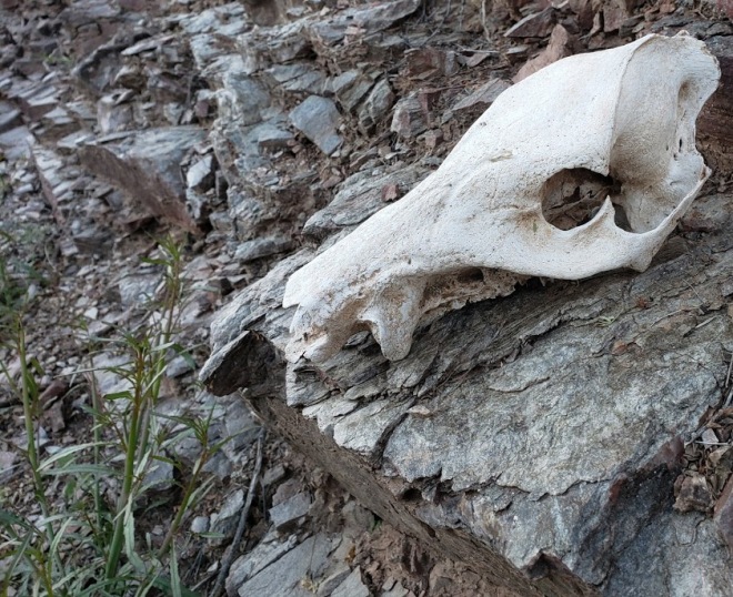
I take baby sips on my water as I make the hot, dry climb above Martinez Canyon, desperately trying to conserve what’s left. The canyon itself is stunning, especially in the golden hour of the evening. At a saddle near the top of the climb, I find a gorgeous chunk of quartz crystal. I sit and admire the geology a bit and pour over my topographic maps in search of the possibility of water.
On the descent, the tiniest of trickles of water comes down from a rock face, and I thank my lucky stars. It takes awhile to fill up, but damn if that isn’t some good water! It’s cool and clear, and I’m so grateful. I walk into the night, as there’s very little in the way of decent camping.
Once the sky is filled with stars, the trail leads me across another ridge, and I find my way via headlamp. The ridge widens out across the top, and I find a good spot to make my bed. Off in the distance is the sparkling lights of Superior, another tiny trail town. The temperatures have dropped dramatically, so I waste no time cuddling down into my quilt. It’s eerily quiet, with no wind or the usual stirrings of creatures.


Day 16: Ridge Camp to Cement Trough, 22 miles
It’s another town day, and even though I’ve just come from Kearny, my replacement trekking pole from CNOC should be at the post office. I plan to be in and out in good time, to make up the miles lost from the unexpected Zero one day prior.
It’s a clear and sunny day, but brisk. There’s frost on the ground, and my first water source, in the way of a creek, is slightly frozen along the banks. There’s several campers along the creek, just waking up and peaking out from their tents. I say good morning, but they seem annoyed by my chipper attitude and ignore me.
Picket Post mountain comes into view as I round a corner, and it’s washed in that gorgeous early dawn light, glowing pink and red against a bluebird sky. The trailhead isn’t far off, and I’m anxious to use the pit toilet there, so I pick up my pace. Several day hikers are out and about, so I feel confident in getting a quick hitch into Superior.

When I arrive at the trailhead, it’s as dead as a ghost town; everyone has already arrived apparently, and are currently out exploring. I do my morning ritual in the privy, and then head towards the highway, searching for a signal on my phone. Maybe I can call a trail angel? And before I can even finish processing that thought, a Jeep rolls in and the driver, Al, offers me a ride.
Al just happens to be the resident trail angel of Superior, and he’s happy to take me around town so I can run my errands. He even offers to make me lunch back at his home!
First he takes me to the post office, where I’m surprised to find that my new trekking pole hasn’t arrived yet. Thankfully, my tiny resupply box is there, even though I really don’t need it. The clerk is super helpful though, and promises to forward my replacement pole to Pine once it arrives.
Al takes me to his home, and makes me a sandwich as I organize my belongings. He offers up a shower and a floor to sleep on, but I decline. I’m ready to put some more miles in, and I’m fine with just washing my hands and face until the next stop. I rummage through the hiker box he has, and donate a few things to it as well. After lunch, he drives me back up to the trailhead and wishes me a safe journey. What a pleasant in and out it was thanks to Al.
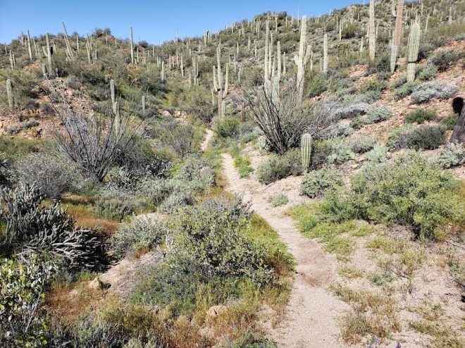
The day has warmed up considerably, so I’m pretty happy to be cooling my tired feet off in a series of creek fords. The trail leads me first across several dirt 4×4 roads, then through riparian forest and a canyon with orange sandstone walls. By the evening, I reach a cement trough with a piped spring pouring into it. There’s a big climb just ahead, which will take me into the Superstition mountains, and after looking at my topo maps, it seems camping may be difficult. I choose to stay in a cramped spot near the trough, surrounded by cholla and other prickly things. I’ll tackle the climb in the morning, but for now, rest and a Nutella wrap for dinner.
I’m now 300 miles in, with 500 to go.

Thanks for Part 3! Beautiful pictures!!!
LikeLike
“Maybe I am braver than I give myself credit for.”
You really are!
Thanks for your great blog and beautiful pictures.
Hopefulle Corona isnt killing my next PCT section Walker pass to ashland. Whats your next trip?
LikeLike
Hi Bart, thanks for reading! I hope you get to do your section too. I had tentative plans to do either the PNT or the Hayduke -or both- but with the current state of things, it’s hard to say.
My job has been affected by COVID19 unfortunately, and I can’t thru hike without a healthy savings. But hopefully with all this free time, I’ll be able to work on catching up my journals.
Cheers!
LikeLike